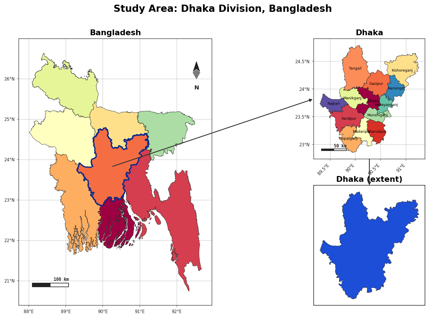
Tutorial: Bangladesh → Dhaka → Madaripur
Build a complete study-area figure for a Bangladeshi research site, from the country down to a
district, ending on real terrain. Everything here runs on the bundled offline data (the
terrain panel needs pip install "acadgis[terrain]").
1. Set up
import acadgis as agis
print("AcadGIS", agis.__version__)

STEPS = [("division", "Dhaka"), ("district", "Madaripur")]
2. The cascade layout
The cascade template gives two context panels (country + division) and a large focus panel
(the district), rendered as terrain:
agis.study_area(
    "Bangladesh", steps=STEPS, template="cascade", terrain=True,
    suptitle="Bangladesh → Dhaka → Madaripur",
)
3. A uniform three-panel series
Prefer three equal panels? Switch the template — the same call, no other changes:
agis.study_area("Bangladesh", steps=STEPS, template="series",
                suptitle="Bangladesh → Dhaka → Madaripur")
4. Customize it
Make the highlight a rectangle, set per-panel graticule spacing, restyle the connectors and turn the focus-box off:
agis.study_area(
    "Bangladesh", steps=STEPS, template="cascade", terrain=True,
    uniform_panels=True,
    highlight_style="rect", highlight_color="#e63946", highlight_alpha=0.25,
    graticule=[True, True, True], graticule_interval=[2, 0.5, 0.1],
    north_arrow=[True, False, True],
    link_color="#1b9aaa", link_style="--", box=False,
    suptitle="Customized cascade",
)
Try a circular highlight, or a border-overlay with the grid off on the focus map:
agis.study_area("Bangladesh", steps=STEPS, template="cascade", terrain=True,
                highlight_style="circle", highlight_color="#2b6cb0",
                highlight_alpha=0.22)

agis.study_area("Bangladesh", steps=STEPS, template="cascade", terrain=True,
                highlight_style="overlay", highlight_color="#2d6a4f",
                graticule=[True, True, False], cmap="gist_earth")
5. Resize the panels
agis.study_area("Bangladesh", steps=STEPS, template="cascade", terrain=True,
                width_ratios=[1, 2.4], height_ratios=[1, 1.3],
                wspace=0.18, hspace=0.22,
                suptitle="Custom panel sizes")
6. Export
Low delta
Bangladesh is a low delta, so Madaripur's relief is gentle — a few metres. Swap terrain=True
for polygon detail, or change the district, with the same call.
Next: India → West Bengal → Kolkata, which adds collected data points.